


| Picture No: | 36 |
| Courtesy of: | Barry Yates |
| Year: | 1819 |
| Add to my Album |
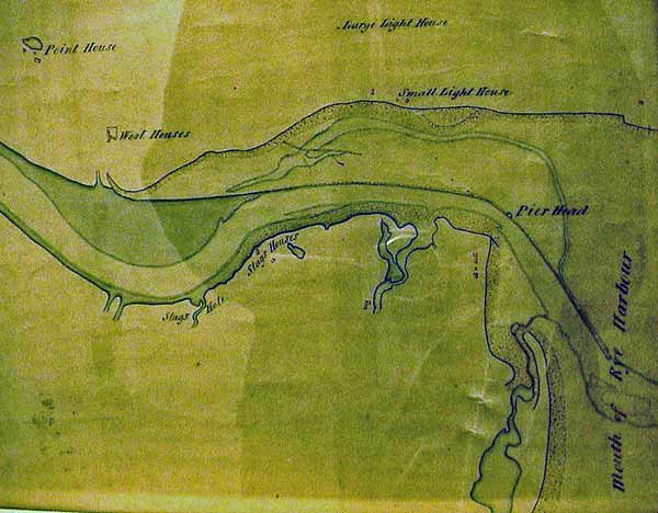
Map by Rennie 1819
The first beginnings of Rye Harbour Village can be seen (down and left of the Pier Head). What buildings are they? The Watch House and ..?
Map was on the wall of Environment Agency's depot at Scott's Float. Title reads "Plan of the River Rother from Rye Harbour to Bodyham Bridge, showing the state of the drown'd Wet Level. Surveyed under the direction of John Rennie Esq. CE FRS.
Picture Added on 17 March 2006.