


| Picture No: | 299 |
| Courtesy of: | Barry Yates |
| Year: | 1819 |
| Add to my Album |
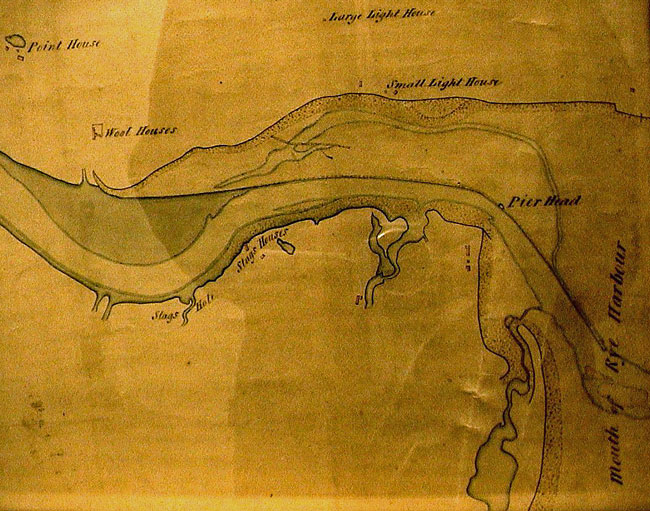
Map of 1819
Part of this old map shows Rye Harbour village as 3 or 4 buildings opposite the Pier Head. Other words on the map are Small Light House, Lareg Light House, Mouth of Rye Harbour, Wool Houses, Point House, Stags Hole, Stags Houses. There is an unnamed building at the inlet to the left of the Rye Harbour Houses.
The map is entitled - Plan of the River Rother from Rye Harbour to Bodyham Bridge, shewing the drown'd state of the Wet Level. Surveyed under the direction of John Rennie Esq. CE, FRS. Oct and Nov 1819.
This map hangs in the Environment Agency offices at Scott's Float, Rye.
Picture Added on 05 January 2011.
For more information on this subject see the following websites.
Rye Harbour