
| Picture No: | 364 |
| Courtesy of: | Barry Yates |
| Year: | 2013 |

| Add to my Album |
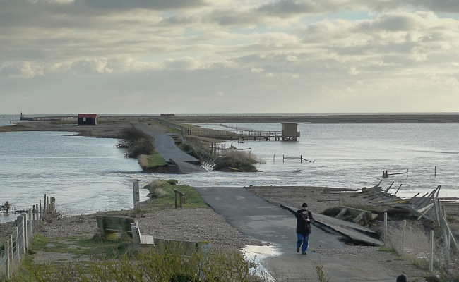
Flood 6th December 2013
A surge tide on the night of 5th/6th December was measured by the harbourmaster at 5.1m.AOD. The road to the shore is about 5.0m. The over topping caused a breach and high tide filled up the low lying ares of the nature reserve. The Sailing Club, Bosun's Bite, Rye Harbour Marine and Lime Kiln Cottage were all flooded but the Environment Agency's new flood defences saved the rest of the village from getting very wet.
Picture Added on 10 December 2013.

Comments


It is interesting to note that there were no defences along the river frontage by the William the Conqueror before 1968, so it's probabaly just as well they were put in.
Also, I seem to remember that the datum level used for these defences was about 4.5m AODN - indeed in 1969 the sea road was overtopped by the caravan park entrance - just before the bank was slightly raised alongside the road.
Added by Chris Coleman on 17 December 2013.